
Repeaters by Channel
| Channel | Callsign | Frequency | Tone | Location | Distance | County | |
|---|---|---|---|---|---|---|---|
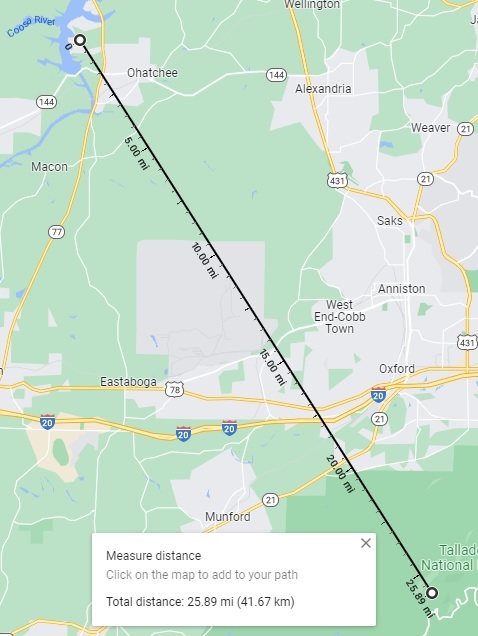
| 1 | WB4GNA | 147.090 | 131.8 | Cheaha Mt. | 25.89 | Cleburne | |
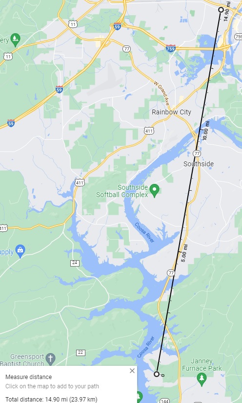
| 2 | K4JMC | 147.160 | 100.0 | Gadsden | 14.90 | Etowah | |
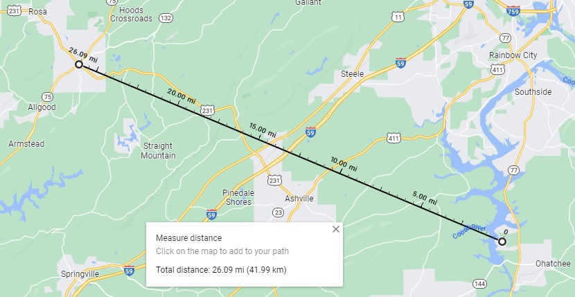
| 3 | KK4CWX | 147.375 | 077.0 | Oneonta | 26.09 | Blount | |
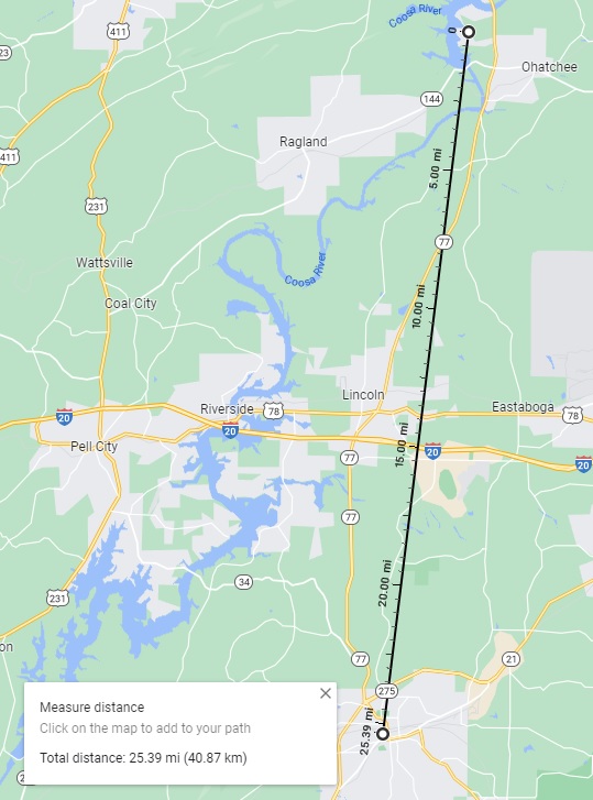
| 4 | N4WNL | 146.740 | 131.8 | Talladega | 25.39 | Talladega | |
| 5 | K4VHF | 146.620 | 146.2 | BR Mt. | 29.14 | St. Clair | |
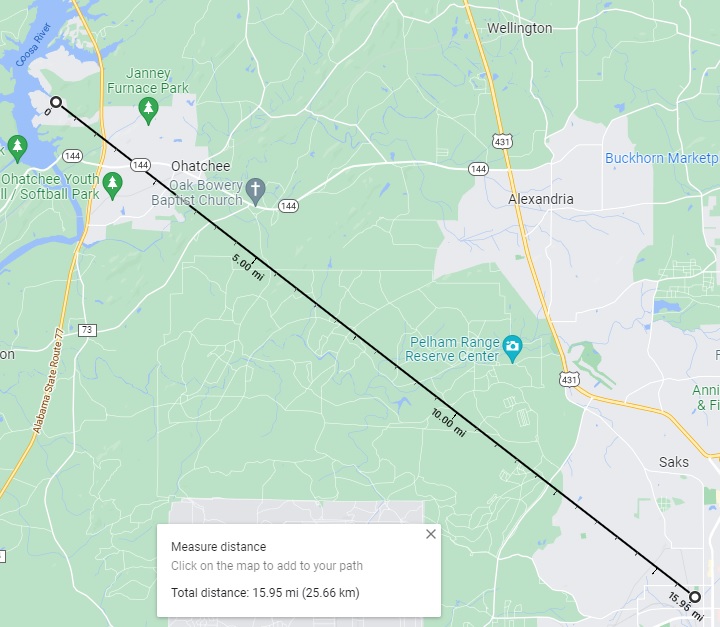
| 6 | WX4CAL | 146.780 | 100.0 | Anniston | 15.95 | Calhoun | |
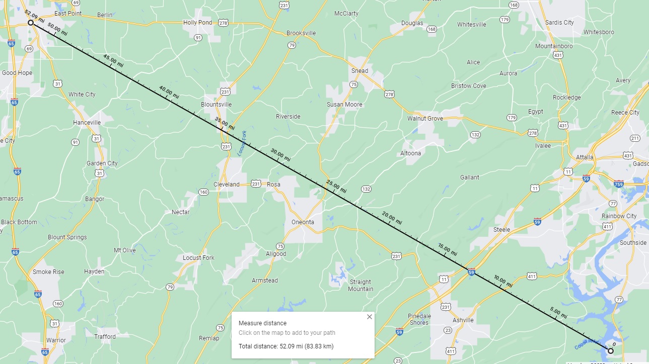
| 7 | N4TUN | 145.310 | 100.0 | Cullman | 52.09 | Cullman | |
| 8 | N4ZDY | 145.370 | Talladega | 25.39 | Talladega | ||
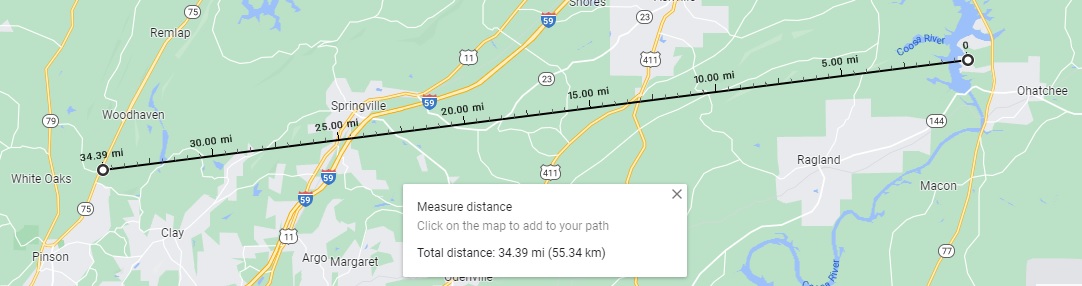
| 9 | KE4QCY | 145.450 | 100.0 | Palmerdale | 34.39 | Jefferson | |
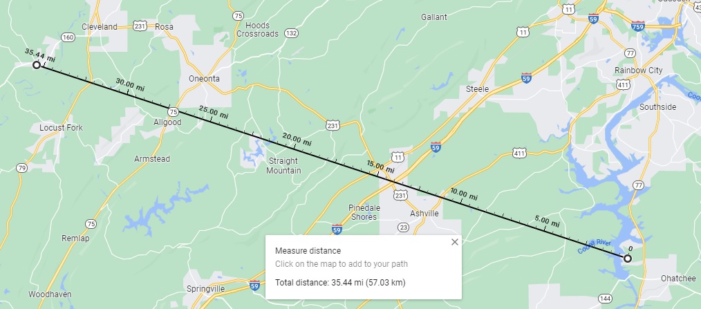
| 10 | W4BLT | 146.700 | 091.5 | Nectar, SB Mt. | 35.44 | Blount | |
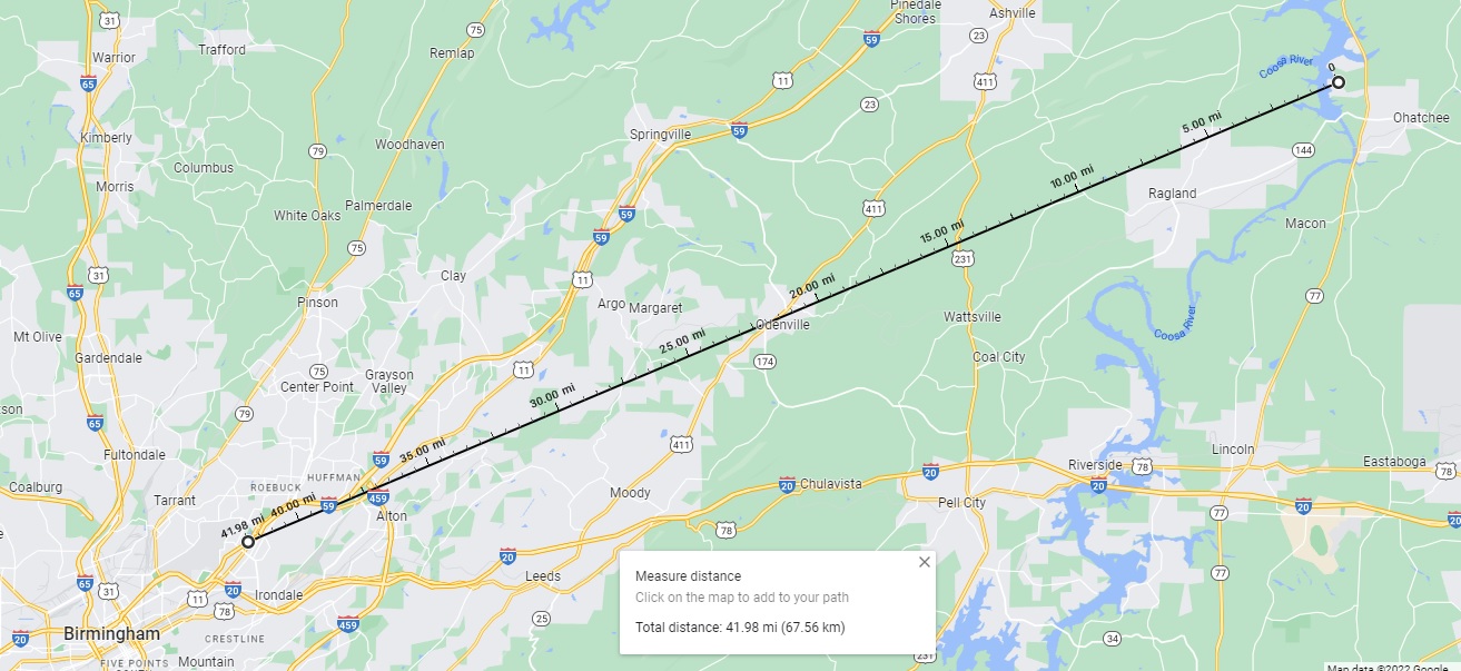
| 11 | KK4BSK | 146.760 | 088.5 | East Lake | 41.98 | Jefferson | |
| 12 | KK4BSK | 146.760 | 114.8 | BR Mt. | 29.14 | St. Clair | |
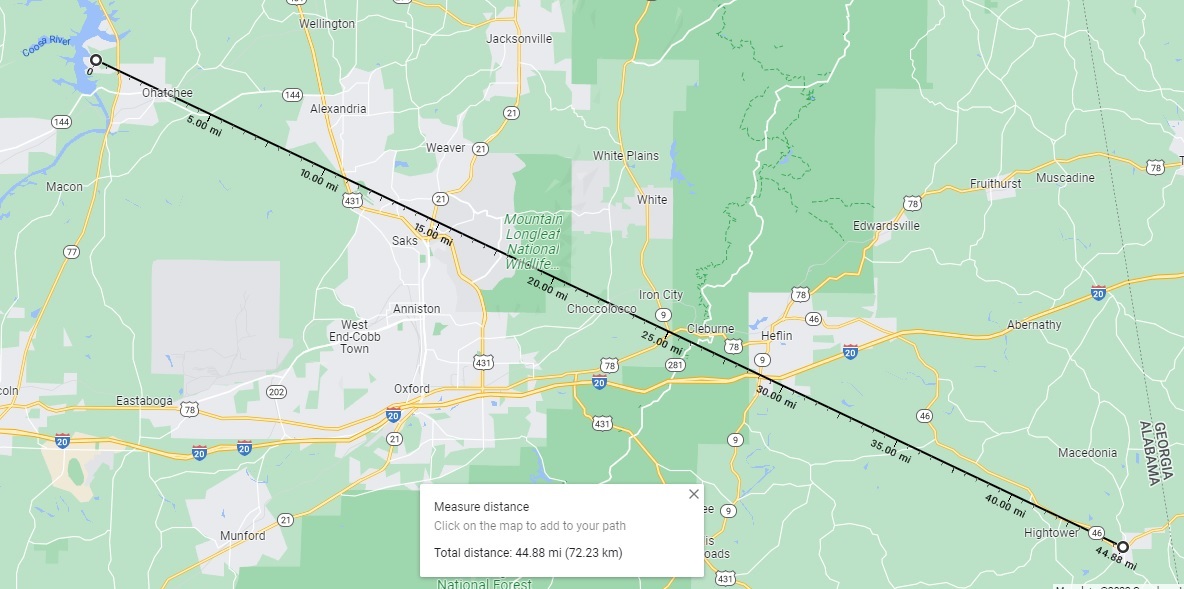
| 13 | N4THM | 146.865 | 131.8 | Ranburne, TH Mt. | 44.88 | Cleburne | |
| 14 | K4AHC | 146.920 | 077.0 | Arab | 43.95 | Marshall | |
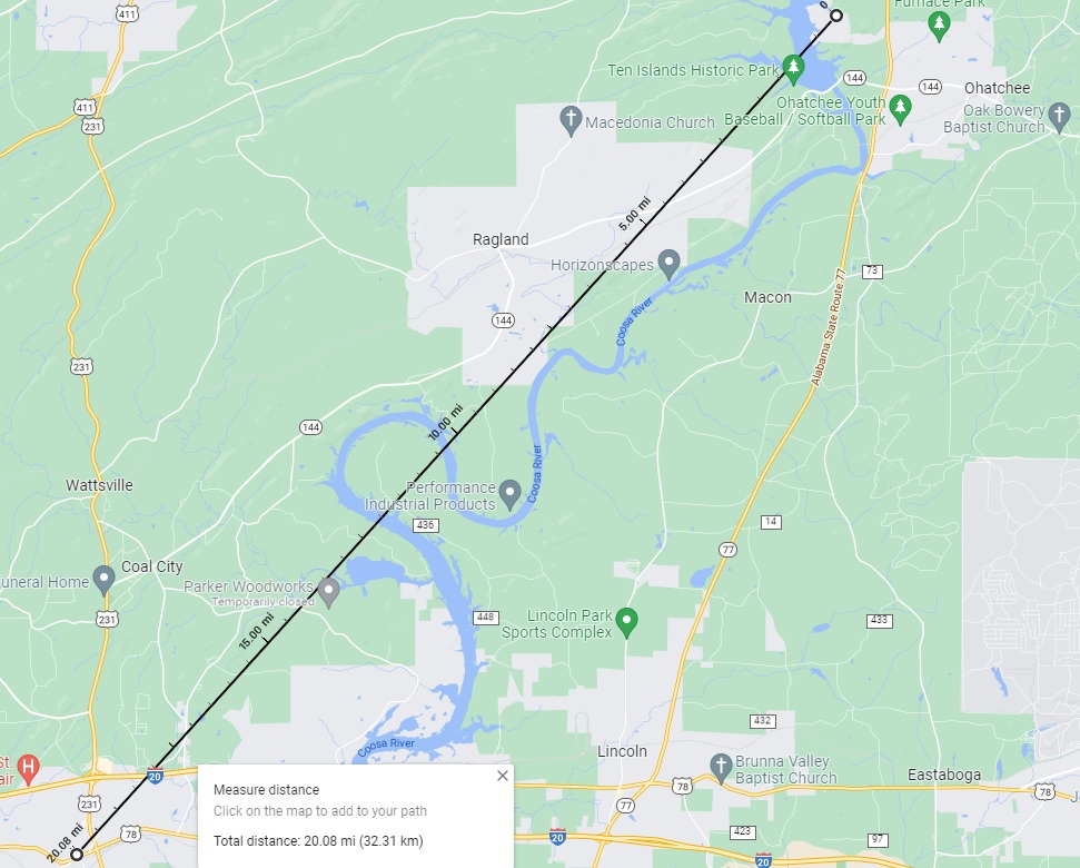
| 15 | N4BRC | 147.020 | Pell City | 20.08 | St. Clair | ||
| 16 | KB4CRG | 147.240 | 82.5 | Huntsville | 71.08 | Madison | |
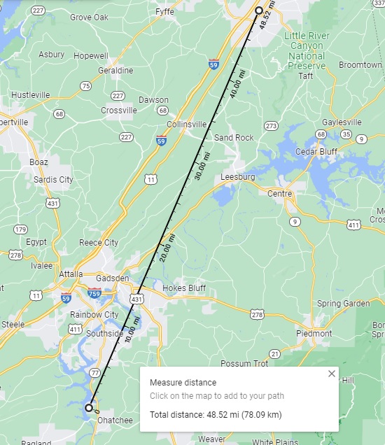
| 17 | W4DGH | 147.270 | 100.0 | Fort Payne, L Mt. | 48.52 | Dekalb | |
| 18 | K4SCC | 145.130 | 103.5 | BR Mt. | 29.14 | St. Clair | |
| 19 | KK4QWH | 147.225 | 100.0 | Summerville, GA | 61.00 | Chatooga |
Abbreviations:
SB=Sky Ball (758'), BR=Bald Rock (1,594'), TH=Turkey Heaven (1,722'), L=Lookout (2,389'), MS=Monte Sano (1,621'), Cheaha (2,411')
Copyright © 2024 Hutch DeLoach